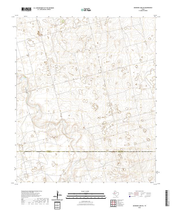
2022 Map of McKenzie Lake SE
USGS Topo · Published 2022About this map
The Gaines Co Andrews Co line bisects this portion of the Texas High Plains, revealing a landscape defined by ephemeral hydrology and a strict rectilinear road network. The most prominent natural feature is Seminole Draw, which meanders through the western half of the quadrangle. This intermittent watercourse provides a rare break in the otherwise consistent topography of the region, where large-scale ranching and land divisions are marked by a grid of county roads. These thoroughfares, including Co Rd 433, Co Rd 428, and Co Rd 422, provide the primary structure for the area's movement and land management. To the south, specialized lanes such as Walley Ln and Ne 601D suggest more localized access points within the expansive ranchlands at the border of Gaines and Andrews Counties.
Find a feature on this map
12 named features on this map. Tap any name to fly to it.
Don’t see what you’re looking for? This feature index may not catch every label — zoom into the map to look around manually.
Map Details
Editions of this 2022 McKenzie Lake SE Map
This is the sole edition of this map. No revisions or reprints were ever made.
Other maps of this area

1954 · Hobbs
USGS Topo · 1:250,000

1958 · Hobbs
USGS Topo · 1:250,000

1966 · Scharbauer Ranch
USGS Topo · 1:24,000

1970 · Cedar Point Ranch
USGS Topo · 1:24,000

1970 · Patricia SW
USGS Topo · 1:24,000

1970 · McKenzie Lake NW
USGS Topo · 1:24,000

1970 · McKenzie Lake SE
USGS Topo · 1:24,000

1970 · Sand
USGS Topo · 1:24,000

1970 · McKenzie Lake
USGS Topo · 1:24,000

1971 · Five Wells Ranch NW
USGS Topo · 1:24,000