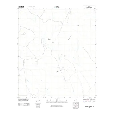
2010 Map of McKinney Mountain
USGS Topo · Published 2010About this map
Paradise Valley and the expansive Green Valley characterize this section of the Trans-Pecos, where high desert elevations meet named summits. The terrain is defined by prominent peaks including Church Mountain, McKinney Mountain, and Turney Peak, which provide topographic landmarks for the region. Water distribution is limited to seasonal drainages such as Crystal Creek, which snakes through the central valleys, and Dogie Creek to the south. This 2010 survey shows a landscape largely shaped by its natural geology rather than dense human settlement, marked by features like The Dike and Red Hill. The sparse network of local roads and 4WD tracks suggests a remote ranching or conservation environment where travel is dictated by the passage between these mountain masses.
Find a feature on this map
9 named features on this map. Tap any name to fly to it.
Don’t see what you’re looking for? This feature index may not catch every label — zoom into the map to look around manually.
Map Details
Editions of this 2010 McKinney Mountain Map
This is the sole edition of this map. No revisions or reprints were ever made.
Other maps of this area

1917 · Agua Fria
USGS Topo · 1:62,500

1917 · Tascotal Mesa
USGS Topo · 1:62,500

1917 · Buck Hill
USGS Topo · 1:62,500

1918 · Buck Hill
USGS Topo · 1:62,500

1918 · Jordan Gap
USGS Topo · 1:62,500

1925 · Buck Hill
USGS Topo · 1:62,500

1930 · Jordan Gap
USGS Topo · 1:62,500

1937 · Agua Fria
USGS Topo · 1:62,500

1944 · Tascotal Mesa
USGS Topo · 1:62,500

1959 · Emory Peak
USGS Topo · 1:250,000