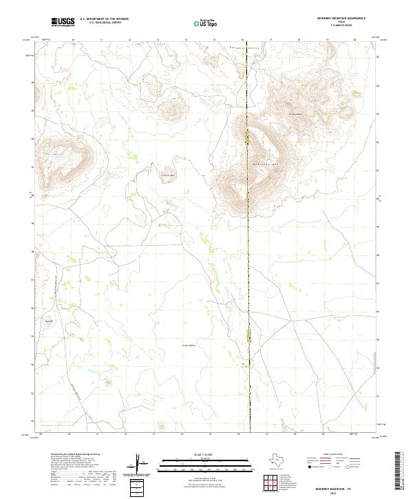
2022 Map of McKinney Mountain
USGS Topo · Published 2022About this map
McKinney Mtn and Turney Peak dominate the high ground in this rugged stretch of West Texas where the boundary between Presidio and Brewster counties follows a rigid north-south meridian. This transition from the volcanic heights of the mountains down into the broad expanse of Green Valley is defined by ephemeral drainage systems like Crystal Cr and Dogie Cr, which cut through the arid basin floor. The landscape is characterized by sparse human infrastructure, primarily centered around Rancho Del Martillo Rd on the western side of the quadrangle. Other prominent elevations include Church Mtn and the isolated Red Hill, providing vertical relief above the sweeping flats of Paradise Valley to the north. The area's character is one of open range and isolated peaks, typical of the high-desert terrain found along the county lines in the Big Bend region.
Find a feature on this map
10 named features on this map. Tap any name to fly to it.
Don’t see what you’re looking for? This feature index may not catch every label — zoom into the map to look around manually.
Map Details
Editions of this 2022 McKinney Mountain Map
This is the sole edition of this map. No revisions or reprints were ever made.
Other maps of this area

1917 · Agua Fria
USGS Topo · 1:62,500

1917 · Tascotal Mesa
USGS Topo · 1:62,500

1917 · Buck Hill
USGS Topo · 1:62,500

1918 · Buck Hill
USGS Topo · 1:62,500

1918 · Jordan Gap
USGS Topo · 1:62,500

1925 · Buck Hill
USGS Topo · 1:62,500

1930 · Jordan Gap
USGS Topo · 1:62,500

1937 · Agua Fria
USGS Topo · 1:62,500

1944 · Tascotal Mesa
USGS Topo · 1:62,500

1959 · Emory Peak
USGS Topo · 1:250,000