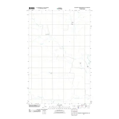
2011 Map of McKinnsey Reservoir West
USGS Topo · Published 2011About this map
Sage Creek and its southern tributary, Little Sage Creek, dominate this prairie landscape in Hill County, where the topography is defined by the managed water resources essential for high-plains agriculture. The drainage patterns are punctuated by several small-scale water management projects, including Burgundy Dam, Hybner Dam, Mercury Dam, and the Langel A C Dam near Flat Coulee. These features represent the localized efforts to capture runoff in an arid environment. The most prominent natural landmark is Black Butte, which rises above the drainages in the eastern portion of the quadrangle. Transport through the area is primarily anchored by Rudyard Rd, which serves as a central artery connecting these remote ranching and farming sites. The presence of Russell Creek in the northwest further illustrates the intricate web of seasonal watercourses that shape the settlement and land-use patterns of this northern Montana region.
Find a feature on this map
10 named features on this map. Tap any name to fly to it.
Don’t see what you’re looking for? This feature index may not catch every label — zoom into the map to look around manually.
Map Details
Editions of this 2011 McKinnsey Reservoir West Map
This is the sole edition of this map. No revisions or reprints were ever made.
Other maps of this area

1919 · Alma
USGS Topo · 1:125,000

1920 · Gildford
USGS Topo · 1:125,000

1943 · Gildford
USGS Topo · 1:125,000

1954 · Shelby
USGS Topo · 1:250,000

1958 · Shelby
USGS Topo · 1:250,000

1969 · Gildford NW
USGS Topo · 1:24,000

1972 · Goldstone SW
USGS Topo · 1:24,000

1972 · Rudyard NW
USGS Topo · 1:24,000

1972 · Mc Kinnsey Reservoir East
USGS Topo · 1:24,000

1972 · Mc Kinnsey Reservoir West
USGS Topo · 1:24,000