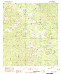
1982 Map of McLain
USGS Topo · Published 1983About this map
The Leaf River winds through the heart of the De Soto National Forest and the Leaf River State Wildlife Management Area in this early 1980s landscape. This survey documents the intersection of rail transit and timberland, with the Illinois Central Gulf railroad passing through the village of McLain. The river's serpentine course is marked by numerous cutoffs and oxbows, such as Hillman Dead River and Daughdrill Dead Lake, illustrating the dynamic nature of the swampy bottomlands.
Find a feature on this map
62 named features on this map. Tap any name to fly to it.
Don’t see what you’re looking for? This feature index may not catch every label — zoom into the map to look around manually.
Map Details
Editions of this 1982 McLain Map
This is the sole edition of this map. No revisions or reprints were ever made.
Other maps of this area

1941 · Lucedale
USGS Topo · 1:62,500

1943 · Lucedale
USGS Topo · 1:62,500

1947 · Beaumont
USGS Topo · 1:62,500

1947 · Benndale
USGS Topo · 1:62,500

1949 · Beaumont
USGS Topo · 1:62,500

1949 · Benndale
USGS Topo · 1:62,500

1953 · Hattiesburg
USGS Topo · 1:250,000

1953 · Mobile
USGS Topo · 1:250,000

1957 · Mobile
USGS Topo · 1:250,000

1958 · Hattiesburg
USGS Topo · 1:250,000