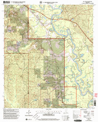
2000 Map of McLain
USGS Topo · Published 2003About this map
The Leaf River dominates this landscape on the boundary of Perry and Greene Counties, where the water carves a complex network of oxbows and secondary channels. Within the protected boundaries of the De Soto National Forest and the Leaf Wilderness, the terrain is defined by low-lying wetlands and named backwaters like Hillman Dead River and Daughdrill Dead Lake. The settlement of McLain serves as a local hub, situated where the Illinois Central Gulf railroad line passes near the river's edge.
Find a feature on this map
66 named features on this map. Tap any name to fly to it.
Don’t see what you’re looking for? This feature index may not catch every label — zoom into the map to look around manually.
Map Details
Editions of this 2000 McLain Map
This is the sole edition of this map. No revisions or reprints were ever made.
Other maps of this area

1941 · Lucedale
USGS Topo · 1:62,500

1943 · Lucedale
USGS Topo · 1:62,500

1947 · Beaumont
USGS Topo · 1:62,500

1947 · Benndale
USGS Topo · 1:62,500

1949 · Beaumont
USGS Topo · 1:62,500

1949 · Benndale
USGS Topo · 1:62,500

1953 · Hattiesburg
USGS Topo · 1:250,000

1953 · Mobile
USGS Topo · 1:250,000

1957 · Mobile
USGS Topo · 1:250,000

1958 · Hattiesburg
USGS Topo · 1:250,000