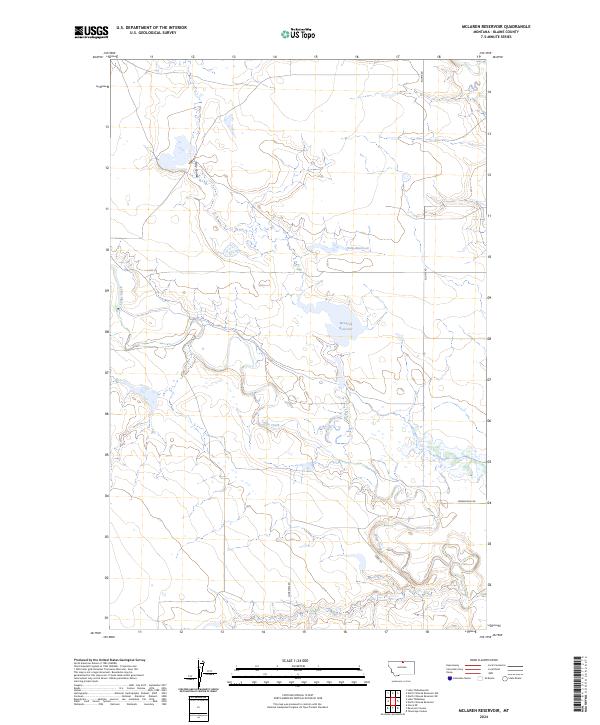
2024 Map of McLaren Reservoir
USGS Topo · Published 2024About this map
Blaine County Waterfowl Production Area dominates the central landscape of this Blaine County region, providing a protected habitat centered around McLaren Reservoir and the nearby Holm Reservoir. The geography is defined by a series of intermittent drainages and coulees, most notably Lodge Creek which winds through the southern and western portions of the quadrangle, and Hay Coulee in the northwest.
Find a feature on this map
13 named features on this map. Tap any name to fly to it.
Don’t see what you’re looking for? This feature index may not catch every label — zoom into the map to look around manually.
Map Details
Editions of this 2024 McLaren Reservoir Map
This is the sole edition of this map. No revisions or reprints were ever made.
Other maps of this area

1904 · Yantic
USGS Topo · 1:62,500

1904 · Havre
USGS Topo · 1:62,500

1912 · Zurich
USGS Topo · 1:125,000

1912 · Thibedeau Lake
USGS Topo · 1:125,000

1953 · Havre
USGS Topo · 1:250,000

1957 · Havre
USGS Topo · 1:250,000

1958 · Havre
USGS Topo · 1:250,000

1964 · Telescope Coulee
USGS Topo · 1:24,000
1964 · Reservoir Coulee
USGS Topo · 1:24,000
1964 · Havre NE
USGS Topo · 1:24,000