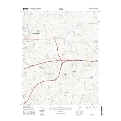
2016 Map of McLeansville
USGS Topo · Published 2016About this map
The suburban and rural landscape east of Greensboro is defined by a complex network of residential growth intersecting with older crossroads settlements. In the northern reaches, McLeansville and Sedalia anchor a region where traditional farm roads like Huffine Mill Rd and Hines Andrews Rd meet modern transportation corridors. The topography is shaped by the headwaters of the Cape Fear basin, with South Buffalo Creek and Little Alamance Cr winding through the terrain. Evidence of the area's agricultural past remains visible through landmarks like Stewarts Mill, Troxlers Mill, and the community of Greesons Crossroads. To the south, Forest Oaks and Lynnwood Lake represent the mid-to-late 20th-century residential expansion of Guilford County. Family history and local heritage are preserved in numerous burial grounds, including Midway Cem and Shady Grove Cem, which remain as permanent fixtures amidst the evolving urban fringe.
Find a feature on this map
203 named features on this map. Tap any name to fly to it.
Don’t see what you’re looking for? This feature index may not catch every label — zoom into the map to look around manually.
Map Details
Editions of this 2016 McLeansville Map
This is the sole edition of this map. No revisions or reprints were ever made.
Other maps of this area

1951 · Lake Brandt
USGS Topo · 1:24,000

1951 · Browns Summit
USGS Topo · 1:24,000

1951 · Greensboro
USGS Topo · 1:24,000

1952 · Mc Leansville
USGS Topo · 1:24,000

1953 · Raleigh
USGS Topo · 1:250,000

1953 · Greensboro
USGS Topo · 1:250,000

1954 · Greensboro
USGS Topo · 1:250,000

1954 · Raleigh
USGS Topo · 1:250,000

1962 · Greensboro
USGS Topo · 1:250,000

1966 · Greensboro
USGS Topo · 1:250,000