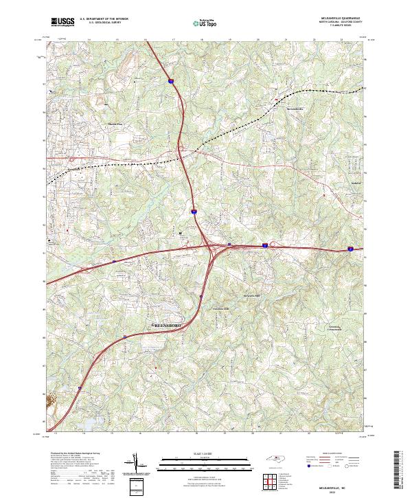
2022 Map of McLeansville
USGS Topo · Published 2022About this map
Greensboro and its eastern suburbs form the core of this modern survey, where urban expansion meets the traditional rural landscapes of Guilford County. The transition from city streets to unincorporated communities is marked by older nodes like Troxlers Mill and Stewarts Mill, which speak to the historic water-powered economy once driven by the Little Alamance Cr. The landscape is dotted with several significant burial grounds, including Midway Cem, Shady Grove Cem, and Piedmont Memorial Cem, providing valuable anchor points for genealogical research in this part of North Carolina.
Find a feature on this map
197 named features on this map. Tap any name to fly to it.
Don’t see what you’re looking for? This feature index may not catch every label — zoom into the map to look around manually.
Map Details
Editions of this 2022 McLeansville Map
This is the sole edition of this map. No revisions or reprints were ever made.
Other maps of this area

1951 · Lake Brandt
USGS Topo · 1:24,000

1951 · Browns Summit
USGS Topo · 1:24,000

1951 · Greensboro
USGS Topo · 1:24,000

1952 · Mc Leansville
USGS Topo · 1:24,000

1953 · Raleigh
USGS Topo · 1:250,000

1953 · Greensboro
USGS Topo · 1:250,000

1954 · Greensboro
USGS Topo · 1:250,000

1954 · Raleigh
USGS Topo · 1:250,000

1962 · Greensboro
USGS Topo · 1:250,000

1966 · Greensboro
USGS Topo · 1:250,000