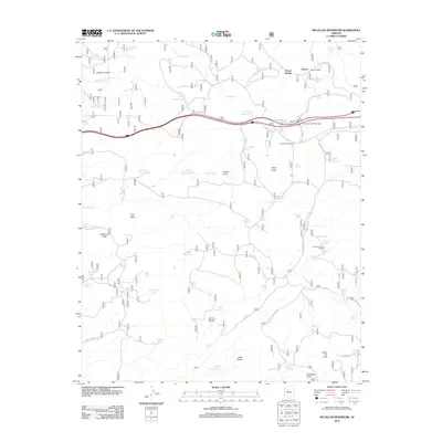
2012 Map of McLellan Reservoir
USGS Topo · Published 2012About this map
Pine Springs Ranch and the Quarter Circle X X Ranch anchor this landscape of high-country ranching and transit in northern Arizona. The area is defined by its complex water management system, necessary for both livestock and steam-era rail operations, featuring numerous named tanks like McLellan Reservoir, McLellan Siding Tank, and Thirteen Mile Tank. This 2012 survey illustrates how modern infrastructure, such as the Pine Springs Interchange, follows the paths of earlier eras, specifically the Old R.R. Grade that once served the settlement of Sereno. The terrain is marked by distinctive geological formations, from the volcanic Johnson Crater in the north to the sheer prominence of Sawtooth Peak and the low-lying reaches of Hells Pocket in the south, reflecting a remote territory where water sources and family-run ranching operations remain the primary landmarks.
Find a feature on this map
78 named features on this map. Tap any name to fly to it.
Don’t see what you’re looking for? This feature index may not catch every label — zoom into the map to look around manually.
Map Details
Editions of this 2012 McLellan Reservoir Map
This is the sole edition of this map. No revisions or reprints were ever made.
Other maps of this area

1886 · Chino
USGS Topo · 1:250,000

1891 · Chino
USGS Topo · 1:250,000

1922 · Williams
USGS Topo · 1:125,000

1947 · Ash Fork
USGS Topo · 1:62,500

1948 · Ash Fork
USGS Topo · 1:63,360

1948 · Williams
USGS Topo · 1:250,000

1949 · Ash Fork
USGS Topo · 1:62,500

1954 · Williams
USGS Topo · 1:250,000

1956 · Williams
USGS Topo · 1:250,000

1960 · Williams
USGS Topo · 1:250,000