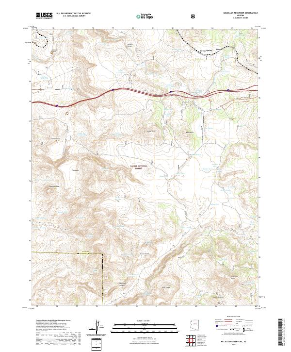
2021 Map of McLellan Reservoir
USGS Topo · Published 2021About this map
Kaibab National Forest dominates this high-altitude landscape in Coconino and Yavapai counties, where the infrastructure of the old west meets modern transport. The map highlights a critical network of water management features, including McLellan Reservoir and dozens of earthen tanks such as Welch Tank and Big Supai Tank, essential for sustaining life and livestock in this arid environment. The northern section of the sheet preserves a segment of historic Americana with the Frontage Rd (Old Rte 66) running parallel to the modern interstate and the railway at McLellan Siding Tank. Geologic landmarks define the horizon, from the volcanic Johnson Crater in the northwest to the prominent Sawtooth Peak and the deep relief of Devil Dog Canyon further south. The small settlement of Sereno and nearby Sereno Spring mark one of the few named habitation points amidst a terrain characterized by named knolls and draws.
Find a feature on this map
78 named features on this map. Tap any name to fly to it.
Don’t see what you’re looking for? This feature index may not catch every label — zoom into the map to look around manually.
Map Details
Editions of this 2021 McLellan Reservoir Map
This is the sole edition of this map. No revisions or reprints were ever made.
Other maps of this area

1886 · Chino
USGS Topo · 1:250,000

1891 · Chino
USGS Topo · 1:250,000

1922 · Williams
USGS Topo · 1:125,000

1947 · Ash Fork
USGS Topo · 1:62,500

1948 · Ash Fork
USGS Topo · 1:63,360

1948 · Williams
USGS Topo · 1:250,000

1949 · Ash Fork
USGS Topo · 1:62,500

1954 · Williams
USGS Topo · 1:250,000

1956 · Williams
USGS Topo · 1:250,000

1960 · Williams
USGS Topo · 1:250,000