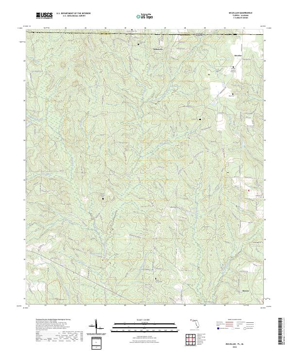
2024 Map of McLellan
USGS Topo · Published 2024About this map
Blackwater River State Forest blankets much of this North Florida landscape, where the state line meets the Alabama-Florida border. The terrain is defined by a dense network of tributaries, including East Fork Big Coldwater Creek and Yellow Water Creek, which drain through the timbered sections of Santa Rosa County. Small rural settlements like McLellan and Sellersville are connected by a web of local routes such as Camp Lowery Rd and Munson Hwy.
Find a feature on this map
74 named features on this map. Tap any name to fly to it.
Don’t see what you’re looking for? This feature index may not catch every label — zoom into the map to look around manually.
Map Details
Editions of this 2024 McLellan Map
This is the sole edition of this map. No revisions or reprints were ever made.
Other maps of this area

1943 · Jay
USGS Topo · 1:62,500

1948 · Munson
USGS Topo · 1:62,500

1950 · Munson
USGS Topo · 1:62,500

1953 · Andalusia
USGS Topo · 1:250,000

1957 · Andalusia
USGS Topo · 1:250,000

1957 · Pensacola
USGS Topo · 1:250,000

1959 · Pensacola
USGS Topo · 1:250,000

1959 · Brewton South
USGS Topo · 1:24,000

1960 · Pensacola
USGS Topo · 1:250,000

1960 · Brewton South
USGS Topo · 1:24,000