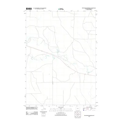
2012 Map of McMaster Reservoir
USGS Topo · Published 2012About this map
Niobrara River meanders across this rural expanse of Niobrara County, defining the drainage patterns of a landscape characterized by intermittent watercourses and significant elevation changes. The northern portion of the map is marked by the winding path of Duck Cr, which feeds into the larger waterway system south of the local height of land. Central to the area's water management is Christian Reservoir, a vital local landmark for livestock or irrigation in this high plains environment. Transportation is limited to a sparse grid of paths and improved surfaces, with McMaster Rd providing primary access through the southern reaches. This 2012 survey illustrates the continued reliance on specialized water infrastructure in eastern Wyoming, where the terrain dictates the location of few maintained roads and local landmarks.
Find a feature on this map
4 named features on this map. Tap any name to fly to it.
Don’t see what you’re looking for? This feature index may not catch every label — zoom into the map to look around manually.
Map Details
Editions of this 2012 McMaster Reservoir Map
This is the sole edition of this map. No revisions or reprints were ever made.
Other maps of this area

1954 · Torrington
USGS Topo · 1:250,000

1958 · Torrington
USGS Topo · 1:250,000

1974 · Mc Master Reservoir
USGS Topo · 1:24,000

1977 · Hileman Draw
USGS Topo · 1:24,000

1977 · Van Tassell
USGS Topo · 1:24,000

1977 · Van Tassell SE
USGS Topo · 1:24,000

1977 · Prairie Center
USGS Topo · 1:24,000
1978 · Node
USGS Topo · 1:24,000

1978 · Kirtley SW
USGS Topo · 1:24,000

1978 · Kirtley
USGS Topo · 1:24,000