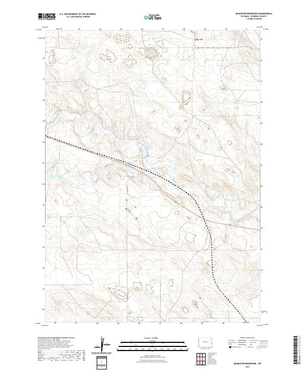
2021 Map of McMaster Reservoir
USGS Topo · Published 2021About this map
The Niobrara River meanders across this high plains landscape of Niobrara County, defining the drainage patterns of a region dedicated to ranching and water management. This contemporary survey highlights the essential role of artificial water storage in the Wyoming interior, featuring McMaster Reservoir and the adjacent McMaster Reservoir Number 4. These sites, along with Christian Reservoir and Dean Reservoir Number 1, provide critical water resources for the surrounding arid terrain. The map is further divided by the rural McMaster Rd, which provides access through the expansive sections of the Public Land Survey System. Streams like Duck Creek (also labeled as Duck Cr) feed into the larger river system, illustrating the subtle topography of the northeastern Wyoming plains.
Find a feature on this map
12 named features on this map. Tap any name to fly to it.
Don’t see what you’re looking for? This feature index may not catch every label — zoom into the map to look around manually.
Map Details
Editions of this 2021 McMaster Reservoir Map
This is the sole edition of this map. No revisions or reprints were ever made.
Other maps of this area

1954 · Torrington
USGS Topo · 1:250,000

1958 · Torrington
USGS Topo · 1:250,000

1974 · Mc Master Reservoir
USGS Topo · 1:24,000

1977 · Hileman Draw
USGS Topo · 1:24,000

1977 · Van Tassell
USGS Topo · 1:24,000

1977 · Van Tassell SE
USGS Topo · 1:24,000

1977 · Prairie Center
USGS Topo · 1:24,000
1978 · Node
USGS Topo · 1:24,000

1978 · Kirtley SW
USGS Topo · 1:24,000

1978 · Kirtley
USGS Topo · 1:24,000