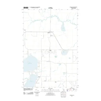
2011 Map of McMillan
USGS Topo · Published 2011About this map
McMillan serves as the central hub of this Luce County landscape, situated at the junction of m28 and the local rail line. The town's civic identity is anchored by the McMillan Post Office and the nearby Columbus Township Cemetery. To the south, the terrain transitions into a dense network of water bodies and recreational grounds, dominated by the expansive North Manistique Lake and Manistique Lake. Here, the settlement of Helmer sits near the Big Lake Campground, illustrating the area's long-standing connection to seasonal lakeside residency and timber-era history.
Find a feature on this map
58 named features on this map. Tap any name to fly to it.
Don’t see what you’re looking for? This feature index may not catch every label — zoom into the map to look around manually.
Map Details
Editions of this 2011 McMillan Map
This is the sole edition of this map. No revisions or reprints were ever made.
Other maps of this area

1931 · Gould City NE
USGS Topo · 1:31,680

1931 · Gould City NW
USGS Topo · 1:31,680

1931 · Seney SE
USGS Topo · 1:31,680

1931 · Blaney NE
USGS Topo · 1:31,680

1954 · Sault Sainte Marie
USGS Topo · 1:250,000

1956 · Sault Sainte Marie
USGS Topo · 1:250,000

1957 · Sault Sainte Marie
USGS Topo · 1:250,000

1958 · Sault Sainte Marie
USGS Topo · 1:250,000

1962 · Auger Lake
USGS Topo · 1:24,000
1972 · Hardwood Island
USGS Topo · 1:24,000