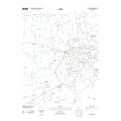
2013 Map of McMinnville
USGS Topo · Published 2013About this map
The Barren Fork and its various tributaries, including Charles Cr and Hickory Cr, carve through the landscape of Warren County, defining the settlement patterns of this Tennessee region. This topographic study reveals a mix of established community centers and specialized agricultural operations, such as the Hilltop Hog Farm and the Two Feathers Bison Ranch. The area around the Warren County Memorial Airport and the Warren County Fairgrounds serves as a hub of activity, connecting the central town to outlying locales like Bethany, Oakland, and Daylight. Significant landmarks such as Ben Lomond Mountain and Lookout Point rise above the drainage basins, while smaller, distinct settlements including Ducks Nest, Smartt, and Lawson Mill dot the valley floors. These names reflect the local heritage and the geographic features that shaped the development of these rural Tennessee neighborhoods.
Find a feature on this map
321 named features on this map. Tap any name to fly to it.
Don’t see what you’re looking for? This feature index may not catch every label — zoom into the map to look around manually.
Map Details
Editions of this 2013 McMinnville Map
This is the sole edition of this map. No revisions or reprints were ever made.
Other maps of this area

1893 · Mc Minnville
USGS Topo · 1:125,000

1895 · Mc Minnville
USGS Topo · 1:125,000

1936 · Morrison
USGS Topo · 1:24,000

1942 · Statesville
USGS Topo · 1:100,000

1943 · Cookeville
USGS Topo · 1:100,000

1943 · Mc Minnville
USGS Topo · 1:100,000

1944 · Cookeville
USGS Topo · 1:100,000

1952 · Centertown
USGS Topo · 1:24,000

1953 · Chattanooga
USGS Topo · 1:250,000

1953 · Centertown
USGS Topo · 1:24,000