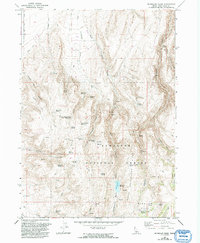
1965 Map of McMullen Basin
USGS Topo · Published 1992About this map
Sawtooth National Forest dominates this high-elevation landscape south of Twin Falls, defined by the sharp rise of Sawtooth Ridge and the complex drainage of McMullen Basin. The map reveals a high-country economy focused on water management and seasonal grazing, evidenced by the density of named water sources like McMullen Cow Camp Spring and Arkansas Spring. Man-made water infrastructure, including Upper Burnt Creek Reservoir, Williams Reservoir, and Curtis Reservoir, points to the careful coordination of resources in this arid Idaho terrain. Steep canyons like Squaw Joe Canyon and broad basins like Horse Basin create a varied topography, while the presence of Gravel Pits in the northern section indicates localized industrial activity amidst the wilderness. This survey, updated with late 20th-century aerial data, captures the essential hydrology and land use patterns of the region.
Find a feature on this map
33 named features on this map. Tap any name to fly to it.
Don’t see what you’re looking for? This feature index may not catch every label — zoom into the map to look around manually.
Map Details
Editions of this 1965 McMullen Basin Map
2 editions found
Other maps of this area

1955 · Twin Falls
USGS Topo · 1:250,000

1958 · Twin Falls
USGS Topo · 1:250,000

1965 · Hollister
USGS Topo · 1:24,000

1965 · Stricker Butte
USGS Topo · 1:24,000

1965 · Berger
USGS Topo · 1:24,000

1965 · Grand View Peak
USGS Topo · 1:24,000

1965 · Hub Butte
USGS Topo · 1:24,000

1965 · Mc Mullen Basin
USGS Topo · 1:24,000

1977 · Rogerson
USGS Topo · 1:24,000

1978 · Hopper Gulch
USGS Topo · 1:24,000