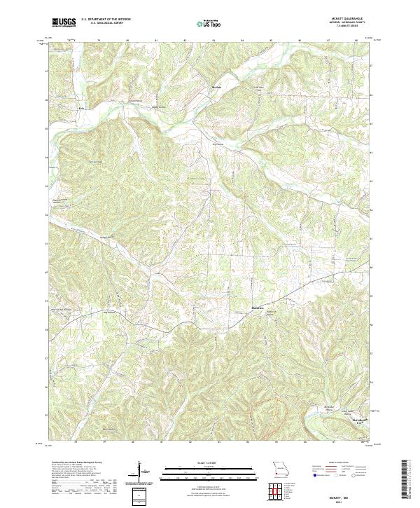
2021 Map of McNatt
USGS Topo · Published 2021About this map
Indian Creek and Elkhorn Cr carve through the heavily dissected landscape of McDonald County, defining a region characterized by named hollows and small rural crossroads. The settlement of McNatt sits north of Coal Mine Hill, while Erie and Plainview serve as local landmarks for these Ozark communities. The terrain is deeply personal, with dozens of family-named or descriptive landforms such as Peach Orchard Hollow, Hungry Hollow, and Thief Hollow illustrating the historical naming conventions of the area's residents. In the south, the waters of Big Sugar Creek flow near McCullough Ford, a river crossing that suggests the importance of local hydrology to transportation before modern bridges. The intricate network of county roads like Rte C and Rte CC follows the ridgelines and creek beds, tracing the movement patterns of this Missouri interior.
Find a feature on this map
91 named features on this map. Tap any name to fly to it.
Don’t see what you’re looking for? This feature index may not catch every label — zoom into the map to look around manually.
Map Details
Editions of this 2021 McNatt Map
This is the sole edition of this map. No revisions or reprints were ever made.
Other maps of this area

1916 · Neosho
USGS Topo · 1:62,500

1940 · Noel
USGS Topo · 1:62,500

1941 · Rocky Comfort
USGS Topo · 1:62,500

1943 · Ritchey
USGS Topo · 1:62,500

1943 · Noel
USGS Topo · 1:62,500

1943 · Rocky Comfort
USGS Topo · 1:62,500

1954 · Tulsa
USGS Topo · 1:250,000

1958 · Tulsa
USGS Topo · 1:250,000

1963 · Tulsa
USGS Topo · 1:250,000
1972 · Neosho West
USGS Topo · 1:24,000