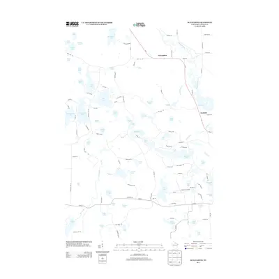
2013 Map of McNaughton
USGS Topo · Published 2013About this map
The Wisconsin River winds through the heart of this Oneida County landscape, serving as the primary drainage for a dense network of glacial water bodies. The small settlements of McNaughton and Newbold are situated along Wi-47, which parallels the river and connects the region's isolated homes and lakeside camps. This 2013 survey illustrates a landscape dominated by water and recreational sites, from the larger Boom Lake and Alva Lake to smaller pockets like Swamp Lake and Lumen Lake. The transportation network is a mix of state highways and local routes like Bridge Rd and Riverview Dr, which provide access to the various springs and inlets. Local landmarks such as the Pine Grove Airport and Camp Birch Rock suggest the area's role as a northern Wisconsin retreat. This map provides a detailed view of the hydrologic pattern of the region, including names of numerous small basins like Maud Lake and Clear Lake.
Find a feature on this map
119 named features on this map. Tap any name to fly to it.
Don’t see what you’re looking for? This feature index may not catch every label — zoom into the map to look around manually.
Map Details
Editions of this 2013 McNaughton Map
This is the sole edition of this map. No revisions or reprints were ever made.
Other maps of this area

1930 · Robbins
USGS Topo · 1:48,000

1938 · Minocqua
USGS Topo · 1:48,000

1938 · Robbins
USGS Topo · 1:48,000

1939 · Cassian
USGS Topo · 1:48,000

1940 · Rhinelander
USGS Topo · 1:48,000

1942 · Cassian
USGS Topo · 1:48,000

1945 · Robbins
USGS Topo · 1:48,000

1946 · Minocqua
USGS Topo · 1:48,000

1949 · Rhinelander
USGS Topo · 1:48,000

1949 · Minocqua
USGS Topo · 1:48,000