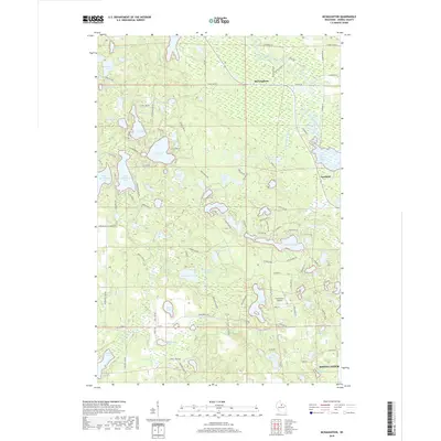
2018 Map of McNaughton
USGS Topo · Published 2018About this map
McNaughton and Newbold anchor this glacial landscape in Oneida County, north of the city of Rhinelander. The region is defined by a dense concentration of kettle lakes and wetlands, including prominent bodies like Alva Lake, West Horsehead Lake, and East Horsehead Lake. Transportation is facilitated by a grid of rural roads and specific recreational routes such as Snowmobile Rd, highlighting the area's modern identity as a hub for outdoor activity. The presence of Pine Grove Airport and the Oneida Cty Landfill Rd illustrates the contemporary infrastructure supporting these northwoods communities. Smaller features like Goodyear Springs and Rice Creek suggest the complex local hydrology that feeds into larger basins like Oneida Lake and Lake Samway. This 2018 survey provides a clear look at the mix of residential lakefront development and managed forest lands that characterize this portion of northern Wisconsin.
Find a feature on this map
112 named features on this map. Tap any name to fly to it.
Don’t see what you’re looking for? This feature index may not catch every label — zoom into the map to look around manually.
Map Details
Editions of this 2018 McNaughton Map
This is the sole edition of this map. No revisions or reprints were ever made.
Other maps of this area

1930 · Robbins
USGS Topo · 1:48,000

1938 · Minocqua
USGS Topo · 1:48,000

1938 · Robbins
USGS Topo · 1:48,000

1939 · Cassian
USGS Topo · 1:48,000

1940 · Rhinelander
USGS Topo · 1:48,000

1942 · Cassian
USGS Topo · 1:48,000

1945 · Robbins
USGS Topo · 1:48,000

1946 · Minocqua
USGS Topo · 1:48,000

1949 · Rhinelander
USGS Topo · 1:48,000

1949 · Minocqua
USGS Topo · 1:48,000