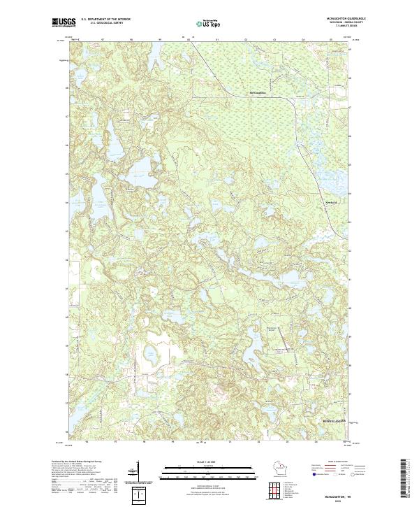
2022 Map of McNaughton
USGS Topo · Published 2022About this map
The Wisconsin River cuts through the northeast corner of this landscape, feeding the Rhinelander Flowage and establishing the water-rich character of Oneida County. Centered on the community of McNaughton, the terrain is defined by an intricate network of glacial lakes and springs, including the paired West Horsehead Lake and East Horsehead Lake. The presence of Newbold Springs and Cedar Spring indicates the importance of local groundwater systems to the region's ecology.
Find a feature on this map
120 named features on this map. Tap any name to fly to it.
Don’t see what you’re looking for? This feature index may not catch every label — zoom into the map to look around manually.
Map Details
Editions of this 2022 McNaughton Map
This is the sole edition of this map. No revisions or reprints were ever made.
Other maps of this area

1930 · Robbins
USGS Topo · 1:48,000

1938 · Minocqua
USGS Topo · 1:48,000

1938 · Robbins
USGS Topo · 1:48,000

1939 · Cassian
USGS Topo · 1:48,000

1940 · Rhinelander
USGS Topo · 1:48,000

1942 · Cassian
USGS Topo · 1:48,000

1945 · Robbins
USGS Topo · 1:48,000

1946 · Minocqua
USGS Topo · 1:48,000

1949 · Rhinelander
USGS Topo · 1:48,000

1949 · Minocqua
USGS Topo · 1:48,000