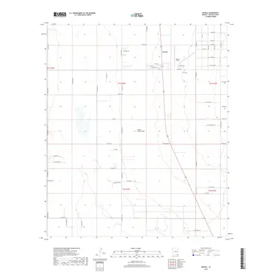
2018 Map of McNeal
USGS Topo · Published 2018About this map
Sulphur Springs Valley defines the landscape of this Cochise County quadrangle, where the settlement of McNeal serves as a central hub for the surrounding agricultural and ranching community. The map reveals a highly structured grid of section lines and rural routes, such as N Central Hwy and N Frontier Rd, which organize the valley floor. For those tracing local history or family lineage, the McNeal Cem and the Tribal Air Airport provide specific points of interest. The area is marked by its transition from township lines like t21s r26e to the south, showcasing the enduring public land survey system that has governed Arizona's development. This 2018 survey detail provides an accurate view of the residential clusters along streets like W McNeal St and W Ivalma St as they appeared in the early 21st century.
Find a feature on this map
57 named features on this map. Tap any name to fly to it.
Don’t see what you’re looking for? This feature index may not catch every label — zoom into the map to look around manually.
Map Details
Editions of this 2018 McNeal Map
This is the sole edition of this map. No revisions or reprints were ever made.
Other maps of this area

1902 · Bisbee
USGS Topo · 1:62,500

1910 · Bisbee
USGS Topo · 1:62,500

1914 · Douglas
USGS Topo · 1:62,500

1916 · Pearce
USGS Topo · 1:125,000

1916 · Douglas
USGS Topo · 1:125,000

1919 · Douglas
USGS Topo · 1:125,000

1922 · Swisshelm
USGS Topo · 1:62,500

1925 · Douglas
USGS Topo · 1:62,500

1925 · Gleeson
USGS Topo · 1:62,500

1927 · Bisbee
USGS Topo · 1:62,500