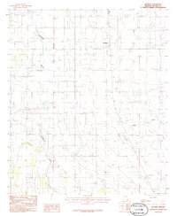
1986 Map of McNeal
USGS Topo · Published 1986About this map
Mc Neal sits within a landscape defined by the drainage patterns of Whitewater Draw and Leslie Creek in the mid-1980s. This agricultural and ranching corridor in Cochise County exhibits a clear grid of section lines and rural infrastructure, including a Sub Station and a Radio Facility located south of the main settlement. The presence of a Landing Strip and a Cem near the town center provides specific points of interest for genealogists and local historians tracing the development of this borderlands region. Several Gravel Pits are noted across the quadrangle, indicating the local extraction of materials from the desert floor. The map’s focus on water courses like Leslie Creek highlights the importance of seasonal drainage in an otherwise arid environment, while the scattered buildings and wells reflect the layout of rural homesteads during this era.
Find a feature on this map
8 named features on this map. Tap any name to fly to it.
Don’t see what you’re looking for? This feature index may not catch every label — zoom into the map to look around manually.
Map Details
Editions of this 1986 McNeal Map
This is the sole edition of this map. No revisions or reprints were ever made.
Other maps of this area

1902 · Bisbee
USGS Topo · 1:62,500

1910 · Bisbee
USGS Topo · 1:62,500

1914 · Douglas
USGS Topo · 1:62,500

1916 · Pearce
USGS Topo · 1:125,000

1916 · Douglas
USGS Topo · 1:125,000

1919 · Douglas
USGS Topo · 1:125,000

1922 · Swisshelm
USGS Topo · 1:62,500

1925 · Douglas
USGS Topo · 1:62,500

1925 · Gleeson
USGS Topo · 1:62,500

1927 · Bisbee
USGS Topo · 1:62,500