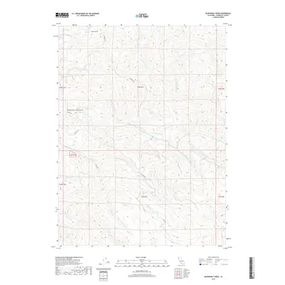
2018 Map of McWhinney Creek
USGS Topo · Published 2018About this map
The N Fork Elk River and its complex network of tributaries dominate this Humboldt County landscape as it appeared in 2018. The map details a heavily dissected terrain defined by drainage systems such as McWhinney Cr and the Little S Fork Elk River, illustrating the watershed's significance to the regional environment. Transportation routes are sparse, primarily following the contours of the land, including Elk River Rd and Cummings Rd, which provide access to this timber-rich area.
Find a feature on this map
30 named features on this map. Tap any name to fly to it.
Don’t see what you’re looking for? This feature index may not catch every label — zoom into the map to look around manually.
Map Details
Editions of this 2018 McWhinney Creek Map
This is the sole edition of this map. No revisions or reprints were ever made.
Other maps of this area

1922 · Eureka
USGS Topo · 1:62,500

1922 · Korbel
USGS Topo · 1:62,500

1922 · Kneeland
USGS Topo · 1:62,500

1933 · Eureka
USGS Topo · 1:48,000

1942 · Eureka
USGS Topo · 1:62,500

1944 · Fortuna
USGS Topo · 1:62,500

1945 · Blue Lake
USGS Topo · 1:62,500

1949 · Eureka
USGS Topo · 1:250,000

1950 · Iaqua Buttes
USGS Topo · 1:62,500

1951 · Eureka
USGS Topo · 1:62,500