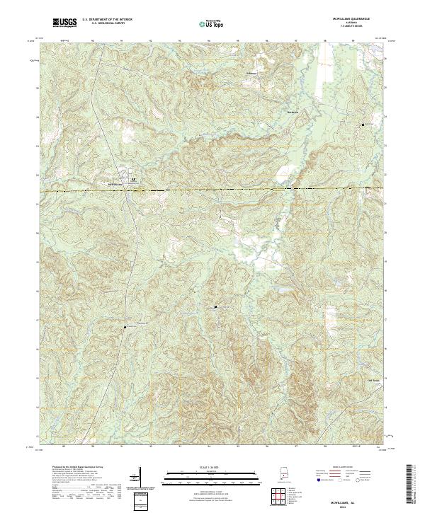
2024 Map of McWilliams
USGS Topo · Published 2024About this map
McWilliams and Old Texas anchor this corner of the Alabama coastal plain, where the topography is defined by the winding course of the West Sepulga River and its numerous tributaries. The landscape is a network of rural homesteads and family cemeteries, including the Pineview Memorial Cem and Grimes Cem. Tracing the border between Monroe and Wilcox counties, the area transitions from the swampy bottomlands of Pudding Swamp to the small lakes and creeks that feed the Sepulga drainage system. Water features like Lake Jane and Lake Patrick are prominent landmarks in a region largely shaped by its timber and agricultural heritage. A grid of local routes such as Holly Rd and Burnsville Rd connects these longstanding settlements, offering a detailed view of the rural infrastructure and land use patterns that have persisted into the modern era.
Find a feature on this map
44 named features on this map. Tap any name to fly to it.
Don’t see what you’re looking for? This feature index may not catch every label — zoom into the map to look around manually.
Map Details
Editions of this 2024 McWilliams Map
This is the sole edition of this map. No revisions or reprints were ever made.
Other maps of this area

1953 · Andalusia
USGS Topo · 1:250,000

1957 · Andalusia
USGS Topo · 1:250,000

1967 · Beatrice
USGS Topo · 1:24,000

1971 · Skinnerton
USGS Topo · 1:24,000

1971 · Bethel
USGS Topo · 1:24,000

1971 · Beatrice
USGS Topo · 1:24,000
1981 · Rosebud
USGS Topo · 1:24,000
1981 · Oak Hill
USGS Topo · 1:24,000

1981 · Pine Apple North
USGS Topo · 1:24,000
1981 · Nadawah
USGS Topo · 1:24,000