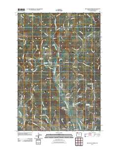
2011 Map of Meacham Corner
USGS Topo · Published 2011About this map
Mountaindale and the surrounding rural uplands of Washington County are characterized by a network of small reservoirs and seasonal drainages at the start of the 21st century. The landscape is defined by the headwaters of East Fork Dairy Creek and McKay Creek, with notable water features like Rails End Reservoir, Spaniol Reservoir, and Dam Site Reservoir punctuating the terrain. For genealogists and local historians, the presence of the Arcade Cemetery near Welches Pond and the Raffety Cemetery further south provides significant points for tracing family roots in this corner of Oregon. Named landmarks such as Meacham Corner, Snooseville Corner, and the Camp Mountaindale facility indicate long-standing community nodes within a region of timber and agriculture. The topography rises toward Bald Mountain and Rye Hill, while ridges like Pumpkin Ridge separate the various creek branches.
Find a feature on this map
82 named features on this map. Tap any name to fly to it.
Don’t see what you’re looking for? This feature index may not catch every label — zoom into the map to look around manually.
Map Details
Editions of this 2011 Meacham Corner Map
This is the sole edition of this map. No revisions or reprints were ever made.
Other maps of this area

1915 · Hillsboro
USGS Topo · 1:62,500

1918 · Hillsboro
USGS Topo · 1:62,500

1922 · St. Helens
USGS Topo · 1:62,500

1940 · Hillsboro
USGS Topo · 1:62,500

1940 · Vernonia
USGS Topo · 1:62,500

1941 · St Helens
USGS Topo · 1:62,500

1941 · Gales Creek
USGS Topo · 1:62,500

1943 · Vernonia
USGS Topo · 1:62,500

1943 · St Helens
USGS Topo · 1:62,500

1948 · Vancouver
USGS Topo · 1:250,000