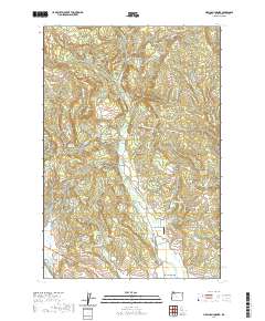
2020 Map of Meacham Corner
USGS Topo · Published 2020About this map
Mountaindale and Meacham Corner anchor this landscape in Washington County, where the foothills meet a complex network of reservoirs and creeks. This 2020 survey illustrates a region defined by its timbered uplands and developed water resources, featuring numerous private impoundments such as Spaniol Reservoir, Rails End Reservoir, and Horning Reservoir. The topography transitions from the high points of Bald Mtn and Pumpkin Ridge down into deep incisions like Big Canyon and Brunswick Canyon.
Find a feature on this map
120 named features on this map. Tap any name to fly to it.
Don’t see what you’re looking for? This feature index may not catch every label — zoom into the map to look around manually.
Map Details
Editions of this 2020 Meacham Corner Map
This is the sole edition of this map. No revisions or reprints were ever made.
Other maps of this area

1915 · Hillsboro
USGS Topo · 1:62,500

1918 · Hillsboro
USGS Topo · 1:62,500

1922 · St. Helens
USGS Topo · 1:62,500

1940 · Hillsboro
USGS Topo · 1:62,500

1940 · Vernonia
USGS Topo · 1:62,500

1941 · St Helens
USGS Topo · 1:62,500

1941 · Gales Creek
USGS Topo · 1:62,500

1943 · Vernonia
USGS Topo · 1:62,500

1943 · St Helens
USGS Topo · 1:62,500

1948 · Vancouver
USGS Topo · 1:250,000