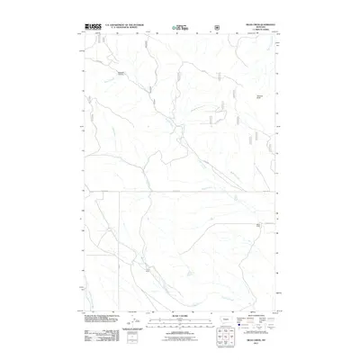
2011 Map of Mead Creek
USGS Topo · Published 2011About this map
Mead Creek and its surrounding drainage basins define this Wheatland County landscape, where watercourses carve through high plains and break into steep features like Sawmill Canyon. The drainage network is complex, featuring the winding paths of Roberts Creek and Antelope Creek as they flow south and east. Ranching remains the primary footprint on the land, with isolated outposts such as Stone Ranch and Lode Ranch situated near the water sources necessary for livestock in this semi-arid environment. The terrain is marked by notable elevations like Stevens Butte, providing vantage points over a grid of utility roads and local routes. These paths, including Haymaker Rd and several forest service access ways, connect the scattered ranching operations across the prairie.
Find a feature on this map
28 named features on this map. Tap any name to fly to it.
Don’t see what you’re looking for? This feature index may not catch every label — zoom into the map to look around manually.
Map Details
Editions of this 2011 Mead Creek Map
This is the sole edition of this map. No revisions or reprints were ever made.
Other maps of this area

1886 · Little Belt Mts.
USGS Topo · 1:250,000

1889 · Big Snowy Mountain
USGS Topo · 1:250,000

1893 · Big Snowy Mountain
USGS Topo · 1:250,000

1894 · Little Belt Mts.
USGS Topo · 1:250,000

1897 · Little Belt Mts.
USGS Topo · 1:250,000

1898 · Little Belt Mts.
USGS Topo · 1:250,000

1902 · Little Belt Mts.
USGS Topo · 1:250,000

1948 · White Sulphur Springs
USGS Topo · 1:250,000

1954 · Roundup
USGS Topo · 1:250,000

1958 · Roundup
USGS Topo · 1:250,000