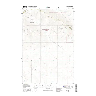
2014 Map of Mead Creek
USGS Topo · Published 2014About this map
The Little Belt Mountains define the northern reaches of this landscape, where the high elevations of the Lewis & Clark National Forest give way to the drainage basins of central Montana. Numerous water sources emerge from these slopes, including 11N14E01BB _01 Spring and 11N14E01AD _02 Spring near the county line between Judith Basin and Wheatland counties. The terrain is marked by distinctive geological formations such as Stevens Butte and deep incisions like Sawmill Canyon and Stevens Gulch. Descending from the forest boundary, the land transitions into a complex network of seasonal and perennial waterways. The central portion is dominated by the course of Mead Cr, while the southern reaches are defined by the winding path of Antelope Cr. This area remains largely undeveloped, with access primarily provided by unpaved tracks such as Lode Rd and Coyote Ln, reflecting a landscape dedicated to conservation and traditional grazing.
Find a feature on this map
21 named features on this map. Tap any name to fly to it.
Don’t see what you’re looking for? This feature index may not catch every label — zoom into the map to look around manually.
Map Details
Editions of this 2014 Mead Creek Map
This is the sole edition of this map. No revisions or reprints were ever made.
Other maps of this area

1886 · Little Belt Mts.
USGS Topo · 1:250,000

1889 · Big Snowy Mountain
USGS Topo · 1:250,000

1893 · Big Snowy Mountain
USGS Topo · 1:250,000

1894 · Little Belt Mts.
USGS Topo · 1:250,000

1897 · Little Belt Mts.
USGS Topo · 1:250,000

1898 · Little Belt Mts.
USGS Topo · 1:250,000

1902 · Little Belt Mts.
USGS Topo · 1:250,000

1948 · White Sulphur Springs
USGS Topo · 1:250,000

1954 · Roundup
USGS Topo · 1:250,000

1958 · Roundup
USGS Topo · 1:250,000