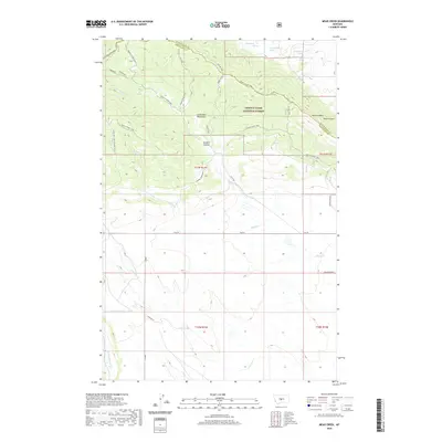
2020 Map of Mead Creek
USGS Topo · Published 2020About this map
The Little Belt Mountains define the northern reaches of this Wheatland County terrain, where the Lewis & Clark National Forest encompasses a landscape of high ridges and deep drainages. Water flows through the central area via Mead Creek and Roberts Creek, carving out features such as Sawmill Canyon and Monk Coulee. The map illustrates a network of specialized access routes through the forest, including the Sawmill Ridge Jeep trail and Canyon View Jeep road, which serve the higher elevations around Stevens Butte. Settlement is sparse in this high-country environment, represented by the Gaugler Ranch in the southeast corner. The transition from public forest land to private ranching property is clearly visible, with Coyote Ln providing access to the southern foothills near Antelope Creek.
Find a feature on this map
29 named features on this map. Tap any name to fly to it.
Don’t see what you’re looking for? This feature index may not catch every label — zoom into the map to look around manually.
Map Details
Editions of this 2020 Mead Creek Map
This is the sole edition of this map. No revisions or reprints were ever made.
Other maps of this area

1886 · Little Belt Mts.
USGS Topo · 1:250,000

1889 · Big Snowy Mountain
USGS Topo · 1:250,000

1893 · Big Snowy Mountain
USGS Topo · 1:250,000

1894 · Little Belt Mts.
USGS Topo · 1:250,000

1897 · Little Belt Mts.
USGS Topo · 1:250,000

1898 · Little Belt Mts.
USGS Topo · 1:250,000

1902 · Little Belt Mts.
USGS Topo · 1:250,000

1948 · White Sulphur Springs
USGS Topo · 1:250,000

1954 · Roundup
USGS Topo · 1:250,000

1958 · Roundup
USGS Topo · 1:250,000