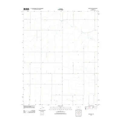
2012 Map of Meade NW
USGS Topo · Published 2012About this map
Crooked Cr meanders across this rural section of Gray County, defining the drainage patterns in an otherwise strictly surveyed landscape. The 2012 survey by the U.S. Geological Survey shows a classic Great Plains grid system, where the township and range lines dictate a network of gravel and dirt roads. These thoroughfares, including J J Rd, Kk Rd, and A Rd, facilitate access to the isolated farmsteads and agricultural plots that dominate the terrain. The map captures the subtle relationship between the natural hydrology of the creek and the human-imposed geometry of the road grid, such as C Rd and D Rd, which frequently adjust to the water's path. This document is a precise record of the regional infrastructure as it existed in the early 21st century, showing the enduring reliance on sectional roads like 10 Rd through 16 Rd.
Find a feature on this map
16 named features on this map. Tap any name to fly to it.
Don’t see what you’re looking for? This feature index may not catch every label — zoom into the map to look around manually.
Map Details
Editions of this 2012 Meade NW Map
This is the sole edition of this map. No revisions or reprints were ever made.
Other maps of this area

1892 · Meade
USGS Topo · 1:125,000

1892 · Dodge
USGS Topo · 1:125,000

1896 · Garden
USGS Topo · 1:125,000

1955 · Dodge City
USGS Topo · 1:250,000

1958 · Dodge City
USGS Topo · 1:250,000

1959 · Dodge City
USGS Topo · 1:250,000

1963 · Plains
USGS Topo · 1:24,000

1963 · Meade
USGS Topo · 1:24,000

1963 · Missler
USGS Topo · 1:24,000

1967 · Plains NE
USGS Topo · 1:24,000