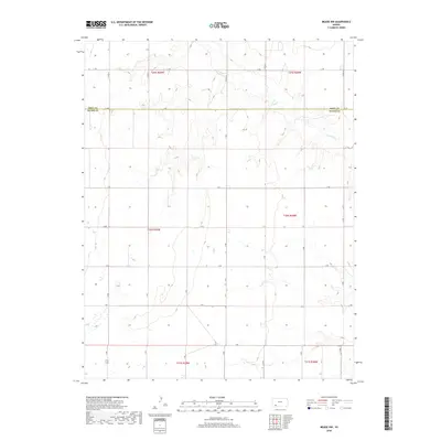
2018 Map of Meade NW
USGS Topo · Published 2018About this map
Crooked Cr meanders across this rural landscape, carving a drainage pattern through the High Plains along the border of Gray Co and Meade Co. The map documents a sparse, strictly organized section of Kansas where the Public Land Survey System defines every boundary and road. A network of section-line roads, including JJ Rd, KK Rd, and G Rd, provides the primary structure for this agricultural area, reflecting the enduring grid of the American West. The terrain is marked by subtle elevation changes and seasonal wetlands, typical of the region's cattle and wheat country, where water sources like Crooked Cr have historically dictated land use and settlement patterns away from established town sites.
Find a feature on this map
28 named features on this map. Tap any name to fly to it.
Don’t see what you’re looking for? This feature index may not catch every label — zoom into the map to look around manually.
Map Details
Editions of this 2018 Meade NW Map
This is the sole edition of this map. No revisions or reprints were ever made.
Other maps of this area

1892 · Meade
USGS Topo · 1:125,000

1892 · Dodge
USGS Topo · 1:125,000

1896 · Garden
USGS Topo · 1:125,000

1955 · Dodge City
USGS Topo · 1:250,000

1958 · Dodge City
USGS Topo · 1:250,000

1959 · Dodge City
USGS Topo · 1:250,000

1963 · Plains
USGS Topo · 1:24,000

1963 · Meade
USGS Topo · 1:24,000

1963 · Missler
USGS Topo · 1:24,000

1967 · Plains NE
USGS Topo · 1:24,000