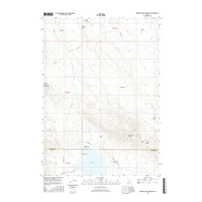
2017 Map of Meadow Creek Mountain
USGS Topo · Published 2017About this map
Blackfoot Reservoir dominates the southern reaches of this landscape, its waters broken by Poison Creek Island and Nettle Island just north of the Bingham Co Caribou Co line. The terrain transitions from the high peaks of the Blackfoot Mountains and Meadow Creek Mountain to unique geological features like the Willow Creek Lava Field and the curious Meteor Hole on Wilson Flat. Transport across this high-elevation area is marked by rugged corridors like Bone Rd and Cranes Flat Rd, which trace the drainage basins of Willow Cr and Meadow Cr. This survey illustrates the intricate relationship between the volcanic geology of the region and the massive water management system of the reservoir and the Blackfoot River in the early 21st century.
Find a feature on this map
37 named features on this map. Tap any name to fly to it.
Don’t see what you’re looking for? This feature index may not catch every label — zoom into the map to look around manually.
Map Details
Editions of this 2017 Meadow Creek Mountain Map
This is the sole edition of this map. No revisions or reprints were ever made.
Other maps of this area

1914 · Henry
USGS Topo · 1:48,000

1916 · Henry
USGS Topo · 1:62,500

1917 · Portneuf
USGS Topo · 1:62,500

1917 · Cranes Flat
USGS Topo · 1:62,500

1918 · Paradise Valley
USGS Topo · 1:62,500

1955 · Driggs
USGS Topo · 1:250,000

1955 · Preston
USGS Topo · 1:250,000

1958 · Driggs
USGS Topo · 1:250,000

1958 · Preston
USGS Topo · 1:250,000

1962 · Driggs
USGS Topo · 1:250,000