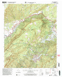
2003 Map of Mecca
USGS Topo · Published 2004About this map
Starr Mountain dominates this portion of the Cherokee National Forest, forming a massive ridge that separates the drainage of Conasauga Creek from the higher elevations of Round Mountain and Hogback Ridge. The settlement of Mecca and nearby Macedonia sit in the northern valleys, while the landscape to the south becomes a dense network of forest service roads and creekside hollows. The presence of numerous small cemeteries such as Adams Cem, Prospect Cem, and Hamby Cem alongside remote houses of worship like the House of Prayer and Union Grove Ch illustrates a long-standing pattern of dispersed mountain communities.
Find a feature on this map
59 named features on this map. Tap any name to fly to it.
Don’t see what you’re looking for? This feature index may not catch every label — zoom into the map to look around manually.
Map Details
Editions of this 2003 Mecca Map
This is the sole edition of this map. No revisions or reprints were ever made.
Other maps of this area

1886 · Cleveland
USGS Topo · 1:125,000

1892 · Cleveland
USGS Topo · 1:125,000

1893 · Murphy
USGS Topo · 1:125,000

1895 · Cleveland
USGS Topo · 1:125,000

1901 · Cleveland
USGS Topo · 1:125,000

1914 · Murphy
USGS Topo · 1:125,000

1934 · Mount Vernon
USGS Topo · 1:24,000

1934 · Mecca
USGS Topo · 1:24,000

1934 · Englewood
USGS Topo · 1:24,000

1934 · Tellico Plains
USGS Topo · 1:24,000