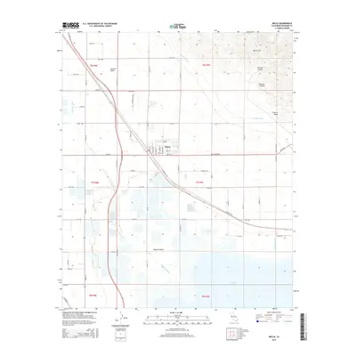
2015 Map of Mecca
USGS Topo · Published 2015About this map
Mecca serves as the central hub of this desert landscape, situated at the junction of the Cochella Valley and the Imperial Valley. The town's grid is bounded by a network of numbered avenues and named streets such as Lincoln St and Johnson St, reflecting the intensive agricultural development that defines the region. To the north and east, the elevation rises sharply into the Mecca Hills, where the terrain is carved by the Painted Canyon, Skeleton Canyon, and the appropriately named Surprise Valley.
Find a feature on this map
56 named features on this map. Tap any name to fly to it.
Don’t see what you’re looking for? This feature index may not catch every label — zoom into the map to look around manually.
Map Details
Editions of this 2015 Mecca Map
This is the sole edition of this map. No revisions or reprints were ever made.
Other maps of this area

1904 · Indio
USGS Topo · 1:125,000

1931 · Vallecito
USGS Topo · 1:125,000

1940 · Cottonwood Spring
USGS Topo · 1:62,500

1940 · Durmid
USGS Topo · 1:62,500

1941 · Coachella
USGS Topo · 1:62,500

1942 · Agua Dulce
USGS Topo · 1:62,500

1943 · Vallecito
USGS Topo · 1:125,000

1943 · Coachella
USGS Topo · 1:62,500

1944 · Agua Dulce
USGS Topo · 1:62,500

1944 · Cottonwood Spring
USGS Topo · 1:62,500