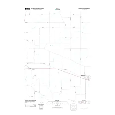
2013 Map of Mechanicsville
USGS Topo · Published 2013About this map
Mechanicsville serves as the central hub of this eastern Iowa landscape, where the historical corridor of the Old Lincoln Hwy cuts a straight path across the terrain. The map reveals a highly structured agricultural grid, defined by a dense network of gravel and paved roads like Cherry Grove Rd and Abbe Hills Rd. This geometric order is interrupted only by the meandering paths of local waterways, including White Oak Creek and Clear Creek, which drain the surrounding farmsteads. The settlement pattern remains concentrated around the town's street grid, while the periphery is dotted with isolated residences and agricultural buildings. For those studying local land use and transportation, the transition from early named routes like Linn Ridge Rd to modern numbered avenues illustrates the evolution of the regional transit network in Cedar County.
Find a feature on this map
67 named features on this map. Tap any name to fly to it.
Don’t see what you’re looking for? This feature index may not catch every label — zoom into the map to look around manually.
Map Details
Editions of this 2013 Mechanicsville Map
This is the sole edition of this map. No revisions or reprints were ever made.
Other maps of this area

1889 · Tipton
USGS Topo · 1:62,500

1890 · Tipton
USGS Topo · 1:62,500

1890 · Anamosa
USGS Topo · 1:62,500

1891 · Monticello
USGS Topo · 1:62,500

1891 · Mechanicsville
USGS Topo · 1:62,500

1894 · Mechanicsville
USGS Topo · 1:62,500

1900 · Anamosa
USGS Topo · 1:125,000

1901 · Stanwood
USGS Topo · 1:125,000

1958 · Davenport
USGS Topo · 1:250,000

1959 · Dubuque
USGS Topo · 1:250,000