2022 Map of Mechanicsville
USGS Topo · Published 2022About this map
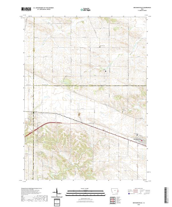
Mechanicsville serves as the primary hub in this eastern Iowa landscape, situated where the Old Lincoln Hwy and US Hwy 30 cross through the rich agricultural terrain of Cedar County. The area is defined by a dense network of country roads like Butcher Rd and Abbe Hills Rd that partition the land into the traditional grid of the Public Land Survey System. Several small drainages, including Pioneer Cr and White Oak Cr, carve through the rolling fields, providing natural relief to the structured farm plots. For those researching local families, the map is a significant resource for locating small, rural burial grounds such as Piper-Kohl Cem, Andre Cem, and Rose Hill Cem. This contemporary survey preserves the placement of these legacy landmarks alongside modern infrastructure like Co Hwy X4F, showing how historical settlements and cemeteries remain anchors in a modernizing rural landscape.
Find a feature on this map
72 named features on this map. Tap any name to fly to it.
Don’t see what you’re looking for? This feature index may not catch every label — zoom into the map to look around manually.
Map Details
Editions of this 2022 Mechanicsville Map
This is the sole edition of this map. No revisions or reprints were ever made.
Historical Maps of Mechanicsville Through Time
4 maps found