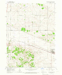
1965 Map of Mechanicsville
USGS Topo · Published 1967About this map
Mechanicsville serves as the primary hub of activity in this mid-1960s Iowa landscape, where the Chicago and North Western railroad cuts a straight path through the township of Pioneer. The map reveals a deeply rural character defined by drainage patterns and early settlement markers, with Spring Creek and South Fork Walnut Creek carving through the agricultural terrain. Small cemeteries like Andre Cem, Pioneer Cem, and Union Cem are scattered across the landscape, providing essential touchpoints for genealogical research and local history.
Find a feature on this map
23 named features on this map. Tap any name to fly to it.
Don’t see what you’re looking for? This feature index may not catch every label — zoom into the map to look around manually.
Map Details
Editions of this 1965 Mechanicsville Map
This is the sole edition of this map. No revisions or reprints were ever made.
Other maps of this area

1889 · Tipton
USGS Topo · 1:62,500

1890 · Tipton
USGS Topo · 1:62,500

1890 · Anamosa
USGS Topo · 1:62,500

1891 · Monticello
USGS Topo · 1:62,500

1891 · Mechanicsville
USGS Topo · 1:62,500

1894 · Mechanicsville
USGS Topo · 1:62,500

1900 · Anamosa
USGS Topo · 1:125,000

1901 · Stanwood
USGS Topo · 1:125,000

1958 · Davenport
USGS Topo · 1:250,000

1959 · Dubuque
USGS Topo · 1:250,000