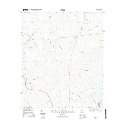
2014 Map of Meda
USGS Topo · Published 2014About this map
The community of Meda serves as a central point in this part of Putnam County, situated where Edward Reeves RD meets Ga-24. The landscape is defined by the dendritic drainage patterns of Rooty Cr and Crooked Cr, which feed into several specialized reservoirs such as Rooty Cr Structure Number 27 Lake and Dennis Lake. These water management features, along with Ashurst Pond and Beall Lake, suggest a rural economy transitioned toward recreation and conservation. Near the Putnam Co and Hancock Co line, the northern reach of Lake Sinclair begins to appear, signaling the shift toward the larger river systems of central Georgia. Moving northeast, the Sparta Hwy connects the smaller settlement at Phoenix to the broader regional network of Greensboro RD, reflecting the persistent importance of these overland routes in the Piedmont terrain.
Find a feature on this map
75 named features on this map. Tap any name to fly to it.
Don’t see what you’re looking for? This feature index may not catch every label — zoom into the map to look around manually.
Map Details
Editions of this 2014 Meda Map
This is the sole edition of this map. No revisions or reprints were ever made.
Other maps of this area

1912 · Milledgeville
USGS Topo · 1:62,500

1953 · Athens
USGS Topo · 1:250,000

1958 · Athens
USGS Topo · 1:250,000

1959 · Athens
USGS Topo · 1:250,000

1963 · Athens
USGS Topo · 1:250,000

1972 · Liberty
USGS Topo · 1:24,000

1972 · Meda
USGS Topo · 1:24,000

1972 · Eatonton
USGS Topo · 1:24,000

1972 · Harmony
USGS Topo · 1:24,000

1972 · Rock Eagle Lake
USGS Topo · 1:24,000