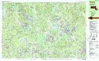
1987 Map of Medfield
USGS Topo · Published 1987About this map
The Charles River winds through the heart of the Norfolk and Middlesex county borderlands, defining the landscape for the established towns of Holliston, Millis, and Medfield. In the late 1980s, this area shows a transition from historical industrial centers like West Medway and Medway to a largely residential and institutional character. The sprawling campus of the Medfield State Hospital stands prominently north of the town center, while the intersection of Conrail lines at Medfield Junction highlights the region's enduring rail connectivity. For those tracing family history, the map is remarkably dense with burial grounds, ranging from the Indian Cem to Vine Lake Cem and Prospect Hill Cem. Recreational and conservation land is equally prominent, featuring the Ashland State Park in the northwest and Highland Lake to the south, surrounded by numerous peaks like Noon Hill and Mount Misery.
Find a feature on this map
117 named features on this map. Tap any name to fly to it.
Don’t see what you’re looking for? This feature index may not catch every label — zoom into the map to look around manually.
Map Details
Editions of this 1987 Medfield Map
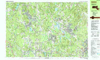
2 editions found
Other maps of this area

1886 · Blackstone
USGS Topo · 1:62,500

1886 · Dedham
USGS Topo · 1:62,500

1886 · Framingham
USGS Topo · 1:62,500

1887 · Franklin
USGS Topo · 1:62,500

1887 · Marlboro
USGS Topo · 1:62,500

1889 · Marlboro
USGS Topo · 1:62,500

1889 · Blackstone
USGS Topo · 1:62,500

1889 · Franklin
USGS Topo · 1:62,500

1889 · Framingham
USGS Topo · 1:62,500

1893 · Franklin
USGS Topo · 1:62,500