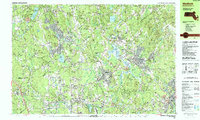
1987 Map of Medfield
USGS Topo · Published 1987About this map
Medfield State Hospital and the expansive Medfield State Forest define the central landscape of this late-twentieth-century study of the Charles River valley. The area exhibits a dense network of suburban growth and institutional presence, with numerous schools such as Kingsbury High Sch and New England Academy serving the established communities of Holliston, Medfield, and Medway.
Find a feature on this map
118 named features on this map. Tap any name to fly to it.
Don’t see what you’re looking for? This feature index may not catch every label — zoom into the map to look around manually.
Map Details
Editions of this 1987 Medfield Map
2 editions found
Other maps of this area

1886 · Blackstone
USGS Topo · 1:62,500

1886 · Dedham
USGS Topo · 1:62,500

1886 · Framingham
USGS Topo · 1:62,500

1887 · Franklin
USGS Topo · 1:62,500

1887 · Marlboro
USGS Topo · 1:62,500

1889 · Marlboro
USGS Topo · 1:62,500

1889 · Blackstone
USGS Topo · 1:62,500

1889 · Franklin
USGS Topo · 1:62,500

1889 · Framingham
USGS Topo · 1:62,500

1893 · Franklin
USGS Topo · 1:62,500