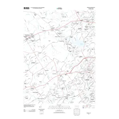
2013 Map of Media
USGS Topo · Published 2013About this map
Newtown Square and Media serve as central anchors for this Delaware County landscape, illustrating the suburban evolution west of Philadelphia. The map detail reflects a densely developed corridor where residential neighborhoods like Marplewood Villa and Florida Park intermingle with significant institutions such as the St Albans Episcopal Church and the Newtown Square School. Waterways such as Crum Cr and the Ridley Cr provide the natural structure for the terrain, punctuated by the sizable Springton Reservoir. The inclusion of Linvill Airport and numerous local landmarks like Media Borough Hall offers a look at the civic and recreational infrastructure of the early 21st century. Smaller named locales such as Sycamore Mills and Florida Park further define the specific community boundaries within the Upper Providence region.
Find a feature on this map
395 named features on this map. Tap any name to fly to it.
Don’t see what you’re looking for? This feature index may not catch every label — zoom into the map to look around manually.
Map Details
Editions of this 2013 Media Map
This is the sole edition of this map. No revisions or reprints were ever made.
Other maps of this area

1894 · Chester
USGS Topo · 1:62,500

1894 · Norristown
USGS Topo · 1:62,500

1895 · Norristown
USGS Topo · 1:62,500

1896 · Norristown
USGS Topo · 1:62,500

1896 · Chester
USGS Topo · 1:62,500

1898 · Chester
USGS Topo · 1:62,500

1901 · Camden
USGS Topo · 1:125,000

1901 · West Chester
USGS Topo · 1:62,500

1904 · West Chester
USGS Topo · 1:62,500

1906 · Phoenixville
USGS Topo · 1:62,500
Featured Places
- Chester, PA
- Radnor Township, PA
- Marple Township, PA
- Upper Providence Township, PA
- Willistown Township, PA