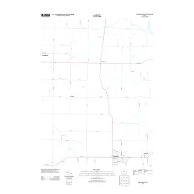
2013 Map of Mediapolis
USGS Topo · Published 2013About this map
Mediapolis serves as the primary hub in this portion of Des Moines County, situated at the intersection of Mediapolis Rd and the main highway corridor. The landscape is defined by a dense network of tributaries including Flint Cr and Hawkeye Cr that drain toward the Iowa River in the northeast corner. This 2013 survey illustrates the enduring agricultural character of the region, where small named settlements like Garland, Newport, and Kossuth are connected by a regular grid of section roads such as 120th Ave and 260th St. To the northwest, the edge of Morning Sun appears, marking the transition into the neighboring township. The map provides a contemporary look at these long-established farming communities, showing how local infrastructure like Iowa City Rd and Co Road H22 continues to follow the historic paths between these rural centers.
Find a feature on this map
60 named features on this map. Tap any name to fly to it.
Don’t see what you’re looking for? This feature index may not catch every label — zoom into the map to look around manually.
Map Details
Editions of this 2013 Mediapolis Map
This is the sole edition of this map. No revisions or reprints were ever made.
Other maps of this area

1934 · Burlington
USGS Topo · 1:48,000

1940 · Burlington
USGS Topo · 1:62,500

1946 · Wapello
USGS Topo · 1:62,500

1949 · Wapello
USGS Topo · 1:62,500

1953 · Toolesboro
USGS Topo · 1:24,000

1958 · Burlington
USGS Topo · 1:250,000

1958 · Davenport
USGS Topo · 1:250,000

1961 · Burlington
USGS Topo · 1:250,000

1961 · Davenport
USGS Topo · 1:250,000

1962 · Davenport
USGS Topo · 1:250,000