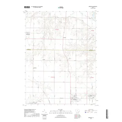
2018 Map of Mediapolis
USGS Topo · Published 2018About this map
Mediapolis anchors this rural landscape at the intersection of local routes, serving as a focal point for the surrounding farming communities of Des Moines and Louisa Counties. The settlement pattern is defined by a grid of agricultural roads, including Mediapolis Rd and Iowa City Rd, which connect the town to outlying hamlets like Garland and Newport. Significant genealogical resources are scattered throughout the countryside, marked by numerous burial grounds such as Bethel Cem, Hazel Grove Cem, and Potter's Timber Cem. To the south near Kossuth, several distinct sites including Linn Grove Cem and Covenanter Cem suggest a history of varied denominational settlements. Waterways like Flint Cr and Honey Cr carve through the section lines, shaping the local topography and drainage patterns around Morning Sun.
Find a feature on this map
52 named features on this map. Tap any name to fly to it.
Don’t see what you’re looking for? This feature index may not catch every label — zoom into the map to look around manually.
Map Details
Editions of this 2018 Mediapolis Map
This is the sole edition of this map. No revisions or reprints were ever made.
Other maps of this area

1934 · Burlington
USGS Topo · 1:48,000

1940 · Burlington
USGS Topo · 1:62,500

1946 · Wapello
USGS Topo · 1:62,500

1949 · Wapello
USGS Topo · 1:62,500

1953 · Toolesboro
USGS Topo · 1:24,000

1958 · Burlington
USGS Topo · 1:250,000

1958 · Davenport
USGS Topo · 1:250,000

1961 · Burlington
USGS Topo · 1:250,000

1961 · Davenport
USGS Topo · 1:250,000

1962 · Davenport
USGS Topo · 1:250,000