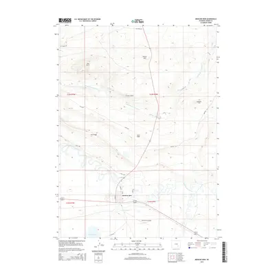
2015 Map of Medicine Bow
USGS Topo · Published 2015About this map
Medicine Bow serves as the central hub of this Carbon County landscape, situated where the high plains meet significant geological formations. The town’s layout is clearly defined by street names like Maple St and Pine St, while the Medicine Bow Airport and the Vandiver Ditch reflect the infrastructure required for aviation and water management in this arid region. The topography is dominated by substantial ridges and peaks, most notably the prominent Flattop Mtn and the extended Fossil Ridge.
Find a feature on this map
28 named features on this map. Tap any name to fly to it.
Don’t see what you’re looking for? This feature index may not catch every label — zoom into the map to look around manually.
Map Details
Editions of this 2015 Medicine Bow Map
This is the sole edition of this map. No revisions or reprints were ever made.
Other maps of this area

1914 · Saddleback Hills
USGS Topo · 1:62,500

1915 · Como Ridge
USGS Topo · 1:48,000

1918 · Como Ridge
USGS Topo · 1:62,500

1921 · Saddleback Hills
USGS Topo · 1:62,500

1954 · Rawlins
USGS Topo · 1:250,000

1955 · Casper
USGS Topo · 1:250,000

1958 · Rawlins
USGS Topo · 1:250,000

1958 · Casper
USGS Topo · 1:250,000
1961 · Walker Draw SE
USGS Topo · 1:24,000

1961 · T B Ranch
USGS Topo · 1:24,000