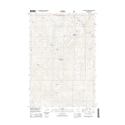
2014 Map of Medicine Hot Springs
USGS Topo · Published 2014About this map
Medicine Hot Springs is the focal point of this mountainous landscape within the Bitterroot National Forest. Located along Us HWY 93 and the East Fork Bitterroot River, this area transitions from the riverside valley to the high ridges of the Bitterroot Mountains. The drainage network is dense with named tributaries such as Warm Springs Cr, Laird Cr, and Maynard Cr, which have carved deep draws and gulches across the terrain. Notable high points like Shook Mtn, Medicine Point, and Coyote Peak define the horizon, while smaller landmarks like Jim Hell Rock and Bear Creek Saddle provide specific navigational points for those traveling through the forest. The map reflects a landscape primarily defined by its hydrology and natural landforms, with human impact concentrated along the highway corridor and at the historic hot springs site.
Find a feature on this map
41 named features on this map. Tap any name to fly to it.
Don’t see what you’re looking for? This feature index may not catch every label — zoom into the map to look around manually.
Map Details
Editions of this 2014 Medicine Hot Springs Map
This is the sole edition of this map. No revisions or reprints were ever made.
Other maps of this area

1955 · Dillon
USGS Topo · 1:250,000

1956 · Elk City
USGS Topo · 1:250,000

1957 · Dillon
USGS Topo · 1:250,000

1958 · Dillon
USGS Topo · 1:250,000

1960 · Elk City
USGS Topo · 1:250,000

1960 · Piquett Mountain
USGS Topo · 1:62,500

1962 · Dillon
USGS Topo · 1:250,000

1964 · Burnt Ridge
USGS Topo · 1:24,000
1964 · Robbins Gulch
USGS Topo · 1:24,000

1964 · Piquett Creek
USGS Topo · 1:24,000