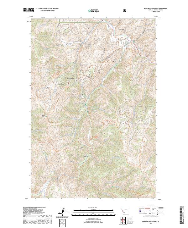
2024 Map of Medicine Hot Springs
USGS Topo · Published 2024About this map
Medicine Hot Springs serves as a central landmark in this mountain landscape, situated along the East Fork Bitterroot River where the valley floor meets the rising peaks. The topography is dominated by the Bitterroot Mountains to the west and the Sapphire Mountains to the northeast, encompassing a large portion of the Bitterroot National Forest. The map reveals a complex network of forest access routes and historical paths, including the Shook Mountain-Medicine Point Trl and the Warm Springs-Ridge Trl, which navigate the steep drainage systems of Laird Creek and Warm Springs Creek. Local family names or early settler influences are preserved in road and trail labels such as Bertie Lord Ln, Noisy Ln, and Lord Draw, providing a geographical record of land use and occupancy in this Ravalli County corridor.
Find a feature on this map
59 named features on this map. Tap any name to fly to it.
Don’t see what you’re looking for? This feature index may not catch every label — zoom into the map to look around manually.
Map Details
Editions of this 2024 Medicine Hot Springs Map
This is the sole edition of this map. No revisions or reprints were ever made.
Other maps of this area

1955 · Dillon
USGS Topo · 1:250,000

1956 · Elk City
USGS Topo · 1:250,000

1957 · Dillon
USGS Topo · 1:250,000

1958 · Dillon
USGS Topo · 1:250,000

1960 · Elk City
USGS Topo · 1:250,000

1960 · Piquett Mountain
USGS Topo · 1:62,500

1962 · Dillon
USGS Topo · 1:250,000

1964 · Burnt Ridge
USGS Topo · 1:24,000
1964 · Robbins Gulch
USGS Topo · 1:24,000

1964 · Piquett Creek
USGS Topo · 1:24,000