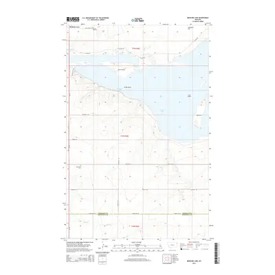
2014 Map of Medicine Lake
USGS Topo · Published 2014About this map
Medicine Lake dominates this northeastern Montana landscape, its waters broken by several named landforms including Big Island, Gull Island, Youngs Island, and Bruces Island. This early 21st-century survey illustrates a region where local geography is tied closely to the water and the surrounding terrain, marked by Umbrights Hill to the northeast. To the south, the headwaters of McCabe Cr drain the higher ground below the Sheridan Co Roosevelt Co line. Rural life and history are anchored by the Medicine Lake Cem and the more remote Homestead Cem. The map shows a transition from conservation areas along Wildlife Dr and the Interpretive Trail to the agricultural grid defined by roads like Bakken Rd and Big Lake Rd.
Find a feature on this map
25 named features on this map. Tap any name to fly to it.
Don’t see what you’re looking for? This feature index may not catch every label — zoom into the map to look around manually.
Map Details
Editions of this 2014 Medicine Lake Map
This is the sole edition of this map. No revisions or reprints were ever made.
Other maps of this area

1914 · Homestead
USGS Topo · 1:62,500

1947 · Capeneys Lake
USGS Topo · 1:24,000

1947 · Homestead
USGS Topo · 1:24,000

1948 · Homestead
USGS Topo · 1:24,000

1948 · Capeneys Lake
USGS Topo · 1:24,000

1948 · Reserve SE
USGS Topo · 1:24,000

1948 · Medicine Lake
USGS Topo · 1:24,000

1948 · Reserve
USGS Topo · 1:24,000

1948 · Alkali Coulee
USGS Topo · 1:24,000

1949 · Reserve SE
USGS Topo · 1:24,000