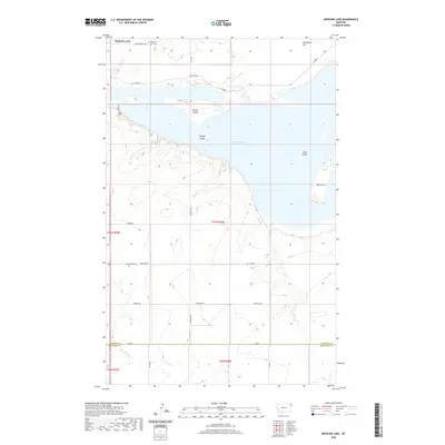
2020 Map of Medicine Lake
USGS Topo · Published 2020About this map
Medicine Lake dominates the upper half of this northeastern Montana landscape, featuring a complex shoreline with numerous named landforms such as Bruces Island, Youngs Island, and Big Island. The topography surrounding the water is marked by significant elevations like Umbrights Hill to the northeast. Settlement and community history are represented by the Medicine Lake Cem near the northern shore and Homestead Cem situated further south along Big Lake Rd. A network of local corridors, including Gull Rd and Longview Rd, provides access to the wildlife-rich margins of the lake. In the southern portion of the map, the terrain levels out near the headwaters of McCabe Cr, which flows across the boundary between Sheridan and Roosevelt Counties.
Find a feature on this map
28 named features on this map. Tap any name to fly to it.
Don’t see what you’re looking for? This feature index may not catch every label — zoom into the map to look around manually.
Map Details
Editions of this 2020 Medicine Lake Map
This is the sole edition of this map. No revisions or reprints were ever made.
Other maps of this area

1914 · Homestead
USGS Topo · 1:62,500

1947 · Capeneys Lake
USGS Topo · 1:24,000

1947 · Homestead
USGS Topo · 1:24,000

1948 · Homestead
USGS Topo · 1:24,000

1948 · Capeneys Lake
USGS Topo · 1:24,000

1948 · Reserve SE
USGS Topo · 1:24,000

1948 · Medicine Lake
USGS Topo · 1:24,000

1948 · Reserve
USGS Topo · 1:24,000

1948 · Alkali Coulee
USGS Topo · 1:24,000

1949 · Reserve SE
USGS Topo · 1:24,000