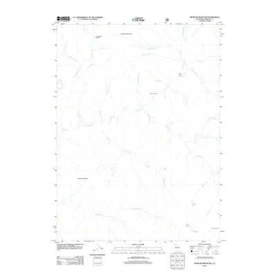
2012 Map of Medicine Mountain
USGS Topo · Published 2012About this map
Medicine Mountain anchors this high-elevation landscape in Siskiyou County, where the 2012 survey details a complex network of canyons and ridges. The terrain is defined by dramatic drainage systems, including Wooley Cr, Rock Cr, and Hancock Cr, which carve through the wilderness toward Steinacher Ridge. This area is characterized by seasonal backcountry hubs such as North Fork Camp, Bear Skull Camp, and Hamilton Camp, which serve as primary landmarks in an otherwise unpopulated mountain expanse.
Find a feature on this map
26 named features on this map. Tap any name to fly to it.
Don’t see what you’re looking for? This feature index may not catch every label — zoom into the map to look around manually.
Map Details
Editions of this 2012 Medicine Mountain Map
This is the sole edition of this map. No revisions or reprints were ever made.
Other maps of this area

1914 · Seiad
USGS Topo · 1:125,000

1922 · Seiad
USGS Topo · 1:125,000

1948 · Weed
USGS Topo · 1:250,000

1950 · Weed
USGS Topo · 1:250,000

1955 · Sawyers Bar
USGS Topo · 1:62,500

1955 · Ukonom Lake
USGS Topo · 1:62,500

1955 · Scott Bar
USGS Topo · 1:62,500

1955 · Forks of Salmon
USGS Topo · 1:62,500

1958 · Weed
USGS Topo · 1:250,000

1963 · Weed
USGS Topo · 1:250,000